Title:
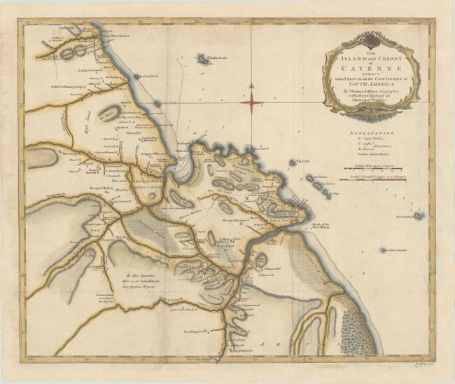
“The Island and Colony of Cayenne Subject to the French, on the Continent of South America”
Map Maker:
Thomas Jefferys
An attractive and detailed map of the vicinity of ... (full text available to subscribers)
| Item Detail |
| |
| |
MapMaker: |
Thomas Jefferys
|
|
| |
| |
Subject: |
French Guiana |
|
| |
Period/Size: |
1768 / 14.4" x 17.4" (36.6 x 44.2 cm)
|
|
| |
Color: |
Colored
|
|
| |
Condition: |
(B+) Issued folding on watermarked paper and now flattened. The margins have been professionally extended with several small chips in the top border replaced in facsimile. A few other small tears and separations have also been archivally repaired on ver (condition help) |
|
| |
Source: |
A General Topography of North America and the West Indies |
|
| |
References: |
Phillips (Maps) p. 214. |
|
| |
|
|
| Sales Information |
| |
| |
Price: |
|
|
| |
| |
Offered by: |
Old World Auctions |
|
| |
Catalog: |
Auction No. 169 - Antique Maps, Charts, Atlases & Globes (9467) |
|
| |
Lot/Item #: |
392 |
|
| |
| |
Date: |
09/2018
|
|
| |
| |
|
Antique Maps - Valuation and Pricing, Descriptions, Resources |
|
Home |
Information |
Search |
Register |
Contact Us |
Site Map
Americana Exchange, Inc. © 1999 - 2024 Americana Exchange, Inc.. All rights reserved.
OldMaps.com, the OldMaps.com logo and
AMPR are service marks or registered service marks of Americana Exchange, Inc..
|