| Item Detail |
| |
| |
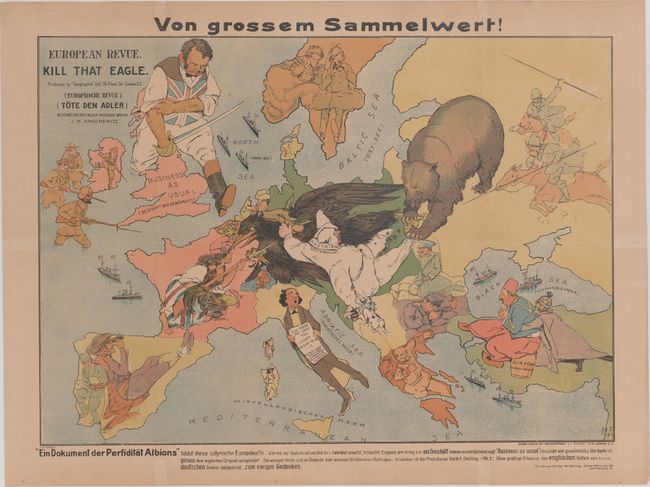
MapMaker: |
Geographia Map Co.
|
|
| |
| |
Subject: |
Europe, World War I |
|
| |
Period/Size: |
1914 / 18.0" x 25.4" (45.8 x 64.6 cm)
|
|
| |
Color: |
Colored
|
|
| |
Condition: |
(B+) Issued folding, now flattened and backed in tissue with a few short archivally repaired tears at fold intersections. Light toning. (condition help) |
|
| |
Source: |
|
|
| |
References: |
Curtis & Pedersen (War Map) pp. 30-31. |
|
| |
|
|
| Sales Information |
| |
| |
Price: |
|
|
| |
| |
Offered by: |
Old World Auctions |
|
| |
Catalog: |
Auction No. 169 - Antique Maps, Charts, Atlases & Globes (9467) |
|
| |
Lot/Item #: |
418 |
|
| |
| |
Date: |
09/2018
|
|
| |
| |
|