Title:
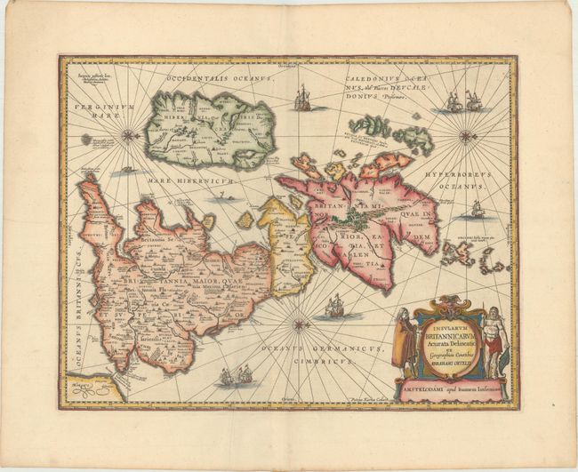
“Insularum Britannicarum Acurata Delineatio ex Geographicis Conatibus Abrahami Ortelii”
Map Maker:
Kaerius/Jansson
A handsome map of the British Isles that has seas ... (full text available to subscribers)
| Item Detail |
| |
| |
MapMaker: |
Kaerius/Jansson
|
|
| |
| |
Subject: |
Britain |
|
| |
Period/Size: |
1680 / 15.3" x 19.8" (38.9 x 50.3 cm)
|
|
| |
Color: |
Colored
|
|
| |
Condition: |
(A) A crisp impression on a clean sheet with an extraneous crease adjacent to the centerfold and light toning along the edges of the sheet. (condition help) |
|
| |
Source: |
|
|
| |
References: |
Shirley (BI to 1650) #466; Van der Krogt (Vol. I) #5000H:1A; Phillips (A) #3427. |
|
| |
|
|
| Sales Information |
| |
| |
Price: |
|
|
| |
| |
Offered by: |
Old World Auctions |
|
| |
Catalog: |
Auction No. 169 - Antique Maps, Charts, Atlases & Globes (9467) |
|
| |
Lot/Item #: |
423 |
|
| |
| |
Date: |
09/2018
|
|
| |
| |
|
Antique Maps - Valuation and Pricing, Descriptions, Resources |
|
Home |
Information |
Search |
Register |
Contact Us |
Site Map
Americana Exchange, Inc. © 1999 - 2024 Americana Exchange, Inc.. All rights reserved.
OldMaps.com, the OldMaps.com logo and
AMPR are service marks or registered service marks of Americana Exchange, Inc..
|