Title:
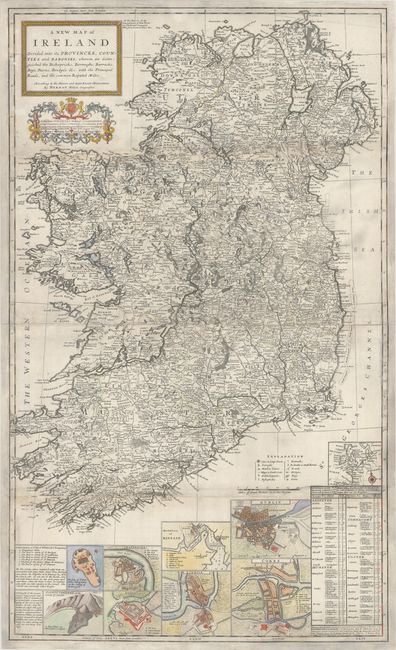
“A New Map of Ireland Divided Into Its Provinces, Counties and Baronies, Wherein Are Distinguished the Bishopricks, Borroughs, Barracks, Bogs, Passes, Bridges &c...”
Map Maker:
Herman Moll
This handsome large map is joined on two sheets an... (full text available to subscribers)
| Item Detail |
| |
| |
MapMaker: |
Herman Moll
|
|
| |
| |
Subject: |
Ireland |
|
| |
Period/Size: |
1714 / 40.1" x 24.1" (101.9 x 61.3 cm)
|
|
| |
Color: |
Colored
|
|
| |
Condition: |
(B) Professionally backed with heavy tissue to reinforce and repair a number of chips along both the upper and lower fold, resulting in some small areas of loss. Numerous edge chips have also been expertly repaired with portions of the border redrawn in (condition help) |
|
| |
Source: |
The World Described; or, A New and Correct Sett of Maps |
|
| |
References: |
Shirley (BL Atlases) T.MOLL-4b #18. |
|
| |
|
|
| Sales Information |
| |
| |
Price: |
|
|
| |
| |
Offered by: |
Old World Auctions |
|
| |
Catalog: |
Auction No. 169 - Antique Maps, Charts, Atlases & Globes (9467) |
|
| |
Lot/Item #: |
449 |
|
| |
| |
Date: |
09/2018
|
|
| |
| |
|
Antique Maps - Valuation and Pricing, Descriptions, Resources |
|
Home |
Information |
Search |
Register |
Contact Us |
Site Map
Americana Exchange, Inc. © 1999 - 2024 Americana Exchange, Inc.. All rights reserved.
OldMaps.com, the OldMaps.com logo and
AMPR are service marks or registered service marks of Americana Exchange, Inc..
|