Title:
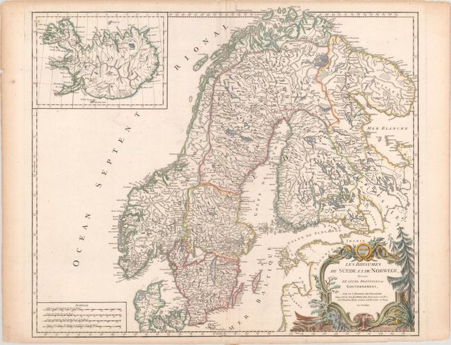
“Les Royaumes de Suede et de Norwege, Divises en Leurs Provinces ou Gouvernemens”
Map Maker:
Didier Robert de Vaugondy
Large and beautifully engraved chart of Sweden, No... (full text available to subscribers)
| Item Detail |
| |
| |
MapMaker: |
Didier Robert de Vaugondy
|
|
| |
| |
Subject: |
Scandinavia |
|
| |
Period/Size: |
1756 / 19.4" x 23.8" (49.3 x 60.5 cm)
|
|
| |
Color: |
Colored
|
|
| |
Condition: |
(B+) On watermarked paper with centerfold reinforcement on verso to repair a few minor edge tears and separations that just enter the image. Minor toning along sheet edges. (condition help) |
|
| |
Source: |
Atlas Universel |
|
| |
References: |
cf. Pedley #68. |
|
| |
|
|
| Sales Information |
| |
| |
Price: |
|
|
| |
| |
Offered by: |
Old World Auctions |
|
| |
Catalog: |
Auction No. 169 - Antique Maps, Charts, Atlases & Globes (9467) |
|
| |
Lot/Item #: |
460 |
|
| |
| |
Date: |
09/2018
|
|
| |
| |
|
Antique Maps - Valuation and Pricing, Descriptions, Resources |
|
Home |
Information |
Search |
Register |
Contact Us |
Site Map
Americana Exchange, Inc. © 1999 - 2024 Americana Exchange, Inc.. All rights reserved.
OldMaps.com, the OldMaps.com logo and
AMPR are service marks or registered service marks of Americana Exchange, Inc..
|