Title:
“Belgicarum Provinciarum Nova Descriptio”
Map Maker:
Luigi Guicciardini
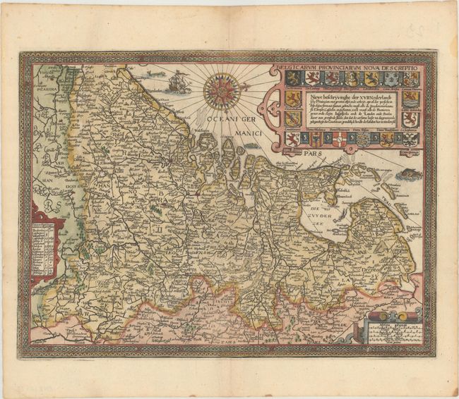
This detailed map shows the Netherlands, Belgium, ... (full text available to subscribers)
| Item Detail |
| |
| |
MapMaker: |
Luigi Guicciardini
|
|
| |
| |
Subject: |
Low Countries |
|
| |
Period/Size: |
1625 / 9.6" x 13.0" (24.4 x 33.1 cm)
|
|
| |
Color: |
Colored
|
|
| |
Condition: |
(A) The impression is a bit weak along the centerfold at bottom, but otherwise excellent. Minor toning along the edges of the sheet. (condition help) |
|
| |
Source: |
Omnium Belgii, sive Inferioris Germaniae Regionum Descriptio |
|
| |
References: |
Shirley (BL Atlases) G.GUIC-3b #1b. |
|
| |
|
|
| Sales Information |
| |
| |
Price: |
|
|
| |
| |
Offered by: |
Old World Auctions |
|
| |
Catalog: |
Auction No. 169 - Antique Maps, Charts, Atlases & Globes (9467) |
|
| |
Lot/Item #: |
482 |
|
| |
| |
Date: |
09/2018
|
|
| |
| |
|
Antique Maps - Valuation and Pricing, Descriptions, Resources |
|
Home |
Information |
Search |
Register |
Contact Us |
Site Map
Americana Exchange, Inc. © 1999 - 2024 Americana Exchange, Inc.. All rights reserved.
OldMaps.com, the OldMaps.com logo and
AMPR are service marks or registered service marks of Americana Exchange, Inc..
|