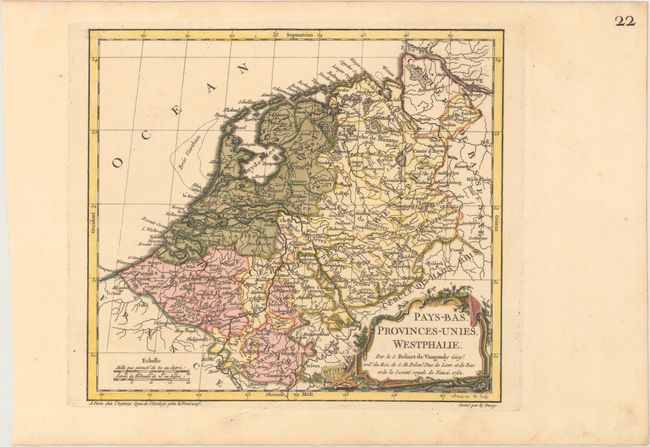
Title:
“Pays-Bas. Provinces Unies, Westphalie”
Map Maker:
Didier Robert de Vaugondy
This delicately engraved map is filled with detail... (full text available to subscribers)
| Item Detail |
| |
| |
MapMaker: |
Didier Robert de Vaugondy
|
|
| |
| |
Subject: |
Low Countries |
|
| |
Period/Size: |
1762 / 9.4" x 10.6" (23.9 x 27.0 cm)
|
|
| |
Color: |
Colored
|
|
| |
Condition: |
(A) A crisp impression with original color in the map and later color in the cartouche on paper with a Strasburg Lily watermark. There is one worm hole in the blank margin at top left. (condition help) |
|
| |
Source: |
Nouvel Atlas Portatif |
|
| |
References: |
Pedley #167. |
|
| |
|
|
| Sales Information |
| |
| |
Price: |
|
|
| |
| |
Offered by: |
Old World Auctions |
|
| |
Catalog: |
Auction No. 169 - Antique Maps, Charts, Atlases & Globes (9467) |
|
| |
Lot/Item #: |
483 |
|
| |
| |
Date: |
09/2018
|
|
| |
| |
|
Antique Maps - Valuation and Pricing, Descriptions, Resources |
|
Home |
Information |
Search |
Register |
Contact Us |
Site Map
Americana Exchange, Inc. © 1999 - 2024 Americana Exchange, Inc.. All rights reserved.
OldMaps.com, the OldMaps.com logo and
AMPR are service marks or registered service marks of Americana Exchange, Inc..
|