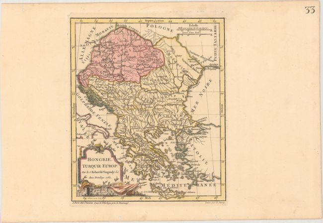
Title:
“Hongrie, Turquie Europ?”
Map Maker:
Didier Robert de Vaugondy
This map of the Balkans extends north to include H... (full text available to subscribers)
| Item Detail |
| |
| |
MapMaker: |
Didier Robert de Vaugondy
|
|
| |
| |
Subject: |
Balkans, Hungary |
|
| |
Period/Size: |
1762 / 9.4" x 8.0" (23.9 x 20.4 cm)
|
|
| |
Color: |
Colored
|
|
| |
Condition: |
(A) A crisp impression with original color in the map and later color in the cartouche on paper with a Strasburg Lily watermark. There are several worm holes confined to the far blank margins. (condition help) |
|
| |
Source: |
Nouvel Atlas Portatif |
|
| |
References: |
Pedley #368. |
|
| |
|
|
| Sales Information |
| |
| |
Price: |
|
|
| |
| |
Offered by: |
Old World Auctions |
|
| |
Catalog: |
Auction No. 169 - Antique Maps, Charts, Atlases & Globes (9467) |
|
| |
Lot/Item #: |
568 |
|
| |
| |
Date: |
09/2018
|
|
| |
| |
|
Antique Maps - Valuation and Pricing, Descriptions, Resources |
|
Home |
Information |
Search |
Register |
Contact Us |
Site Map
Americana Exchange, Inc. © 1999 - 2024 Americana Exchange, Inc.. All rights reserved.
OldMaps.com, the OldMaps.com logo and
AMPR are service marks or registered service marks of Americana Exchange, Inc..
|