Title:
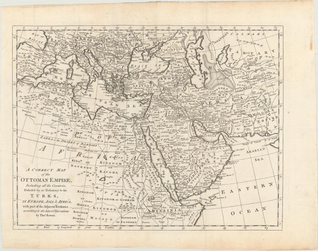
“A Correct Map of the Ottoman Empire, Including All the Countries, Possess'd by, or Tributary to the Turks, in Europe, Asia & Africa...”
Map Maker:
Thomas Bowen
This map illustrates the expansive Ottoman Empire ... (full text available to subscribers)
| Item Detail |
| |
| |
MapMaker: |
Thomas Bowen
|
|
| |
| |
Subject: |
Mediterranean, Middle East & Northern Africa |
|
| |
Period/Size: |
1777 / 12.3" x 16.3" (31.3 x 41.4 cm)
|
|
| |
Color: |
Black & White
|
|
| |
Condition: |
(A) A crisp impression with a few minor spots and tiny worm tracks that are confined to the top blank margin. (condition help) |
|
| |
Source: |
A New and Complete System of Geography... |
|
| |
References: |
McCorkle (18th C. Geography Books) #280 [4]. |
|
| |
|
|
| Sales Information |
| |
| |
Price: |
|
|
| |
| |
Offered by: |
Old World Auctions |
|
| |
Catalog: |
Auction No. 169 - Antique Maps, Charts, Atlases & Globes (9467) |
|
| |
Lot/Item #: |
633 |
|
| |
| |
Date: |
09/2018
|
|
| |
| |
|
Antique Maps - Valuation and Pricing, Descriptions, Resources |
|
Home |
Information |
Search |
Register |
Contact Us |
Site Map
Americana Exchange, Inc. © 1999 - 2024 Americana Exchange, Inc.. All rights reserved.
OldMaps.com, the OldMaps.com logo and
AMPR are service marks or registered service marks of Americana Exchange, Inc..
|