Title:
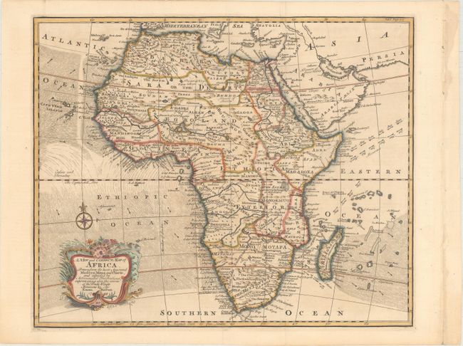
“A New and Correct Map of Africa. Drawn from the Most Approved Modern Maps and Charts, and Adjusted by Astronomical Observations...”
Map Maker:
Emanuel Bowen
Finely engraved map of the continent that is notab... (full text available to subscribers)
| Item Detail |
| |
| |
MapMaker: |
Emanuel Bowen
|
|
| |
| |
Subject: |
Africa |
|
| |
Period/Size: |
1748 / 14.4" x 17.6" (36.6 x 44.7 cm)
|
|
| |
Color: |
Colored
|
|
| |
Condition: |
(A) Attractive color on a clean sheet. There are some binding holes in the far right blank margin that have been reinforced with non-archival tape on verso that do not impact the image. (condition help) |
|
| |
Source: |
Harris' Collection of Voyages |
|
| |
References: |
Norwich #89. |
|
| |
|
|
| Sales Information |
| |
| |
Price: |
|
|
| |
| |
Offered by: |
Old World Auctions |
|
| |
Catalog: |
Auction No. 169 - Antique Maps, Charts, Atlases & Globes (9467) |
|
| |
Lot/Item #: |
717 |
|
| |
| |
Date: |
09/2018
|
|
| |
| |
|
Antique Maps - Valuation and Pricing, Descriptions, Resources |
|
Home |
Information |
Search |
Register |
Contact Us |
Site Map
Americana Exchange, Inc. © 1999 - 2024 Americana Exchange, Inc.. All rights reserved.
OldMaps.com, the OldMaps.com logo and
AMPR are service marks or registered service marks of Americana Exchange, Inc..
|