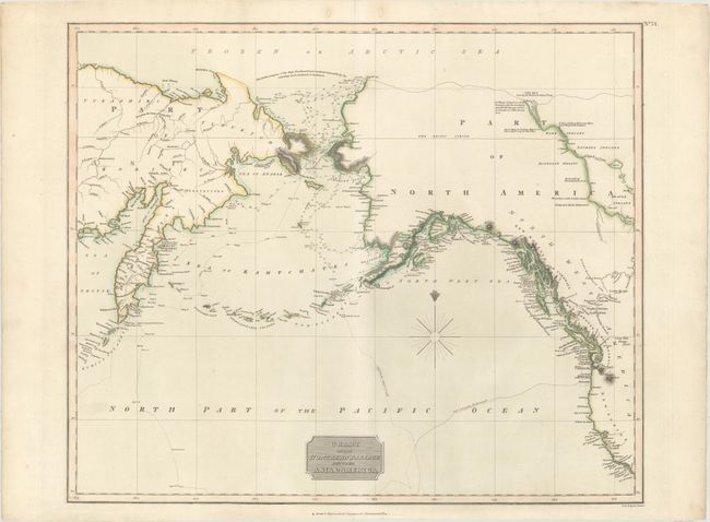
Title:
“Chart of the Northern Passage Between Asia & America”
Map Maker:
John Thomson [& Co.]
Very informative and large map showing the develop... (full text available to subscribers)
| Item Detail |
| |
| |
MapMaker: |
John Thomson [& Co.]
|
|
| |
| |
Subject: |
North Pacific Ocean |
|
| |
Period/Size: |
1814 / 19.4" x 23.1" (49.3 x 58.7 cm)
|
|
| |
Color: |
Colored
|
|
| |
Condition: |
(A) On a clean sheet with two worm holes in the top blank margin that have been infilled with archival material on verso. (condition help) |
|
| |
Source: |
Thomson's New General Atlas |
|
| |
References: |
|
|
| |
|
|
| Sales Information |
| |
| |
Price: |
|
|
| |
| |
Offered by: |
Old World Auctions |
|
| |
Catalog: |
Auction No. 169 - Antique Maps, Charts, Atlases & Globes (9467) |
|
| |
Lot/Item #: |
753 |
|
| |
| |
Date: |
09/2018
|
|
| |
| |
|
Antique Maps - Valuation and Pricing, Descriptions, Resources |
|
Home |
Information |
Search |
Register |
Contact Us |
Site Map
Americana Exchange, Inc. © 1999 - 2024 Americana Exchange, Inc.. All rights reserved.
OldMaps.com, the OldMaps.com logo and
AMPR are service marks or registered service marks of Americana Exchange, Inc..
|