Title:
“Report on the United States and Mexican Boundary Survey, Made Under the Direction of the Secretary of the Interior ... Volume I”
Map Maker:
William Hemsley Emory
After the Treaty of Guadeloupe, Hidalgo (1848), wh... (full text available to subscribers)
| Item Detail |
| |
| |
MapMaker: |
William Hemsley Emory
|
|
| |
| |
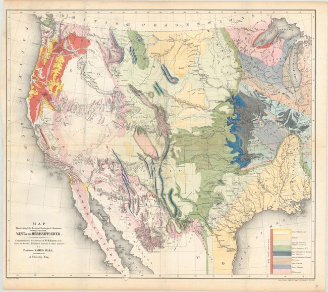
Subject: |
Exploration & Surveys, Mexican Boundary |
|
| |
Period/Size: |
1857 / 11.7" x 9.2" (29.8 x 23.4 cm)
|
|
| |
Color: |
Colored
|
|
| |
Condition: |
(B+) Condition code is for the two maps which are generally clean and bright with a bit of minor foxing. The colorful geological map has a 7.5" edge tear at left and a tiny hole at center that have both been repaired on verso with archival materials. Te (condition help) |
|
| |
Source: |
Ex. Doc. No. 108, 34th Cong, 1st Sess. |
|
| |
References: |
Wheat (TMW) #916 & #922; Marcou & Marcou #52; Blevins Wyoming #76. |
|
| |
|
|
| Sales Information |
| |
| |
Price: |
|
|
| |
| |
Offered by: |
Old World Auctions |
|
| |
Catalog: |
Auction No. 169 - Antique Maps, Charts, Atlases & Globes (9467) |
|
| |
Lot/Item #: |
793 |
|
| |
| |
Date: |
09/2018
|
|
| |
| |
|
Antique Maps - Valuation and Pricing, Descriptions, Resources |
|
Home |
Information |
Search |
Register |
Contact Us |
Site Map
Americana Exchange, Inc. © 1999 - 2024 Americana Exchange, Inc.. All rights reserved.
OldMaps.com, the OldMaps.com logo and
AMPR are service marks or registered service marks of Americana Exchange, Inc..
|