| Item Detail |
| |
| |
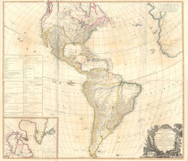
MapMaker: |
Laurie & Whittle
|
|
| |
| |
Subject: |
Western Hemisphere - America |
|
| |
Period/Size: |
1794 / 20.2" x 46.6" (51.3 x 118.4 cm)
|
|
| |
Color: |
Colored
|
|
| |
Condition: |
(B+) A nice impression with contemporary color, some color offsetting, several faint damps stains, and a few extraneous creases along the folds. There are a couple of tiny fold separations confined to the blank margins. The bluish shadows along the left (condition help) |
|
| |
Source: |
|
|
| |
References: |
Tooley (America) p. 52, #3.f; McGuirk #112. |
|
| |
|
|
| Sales Information |
| |
| |
Price: |
|
|
| |
| |
Offered by: |
Old World Auctions |
|
| |
Catalog: |
Auction No. 170 - Antique Maps, Charts, Atlases & Globes (9468) |
|
| |
Lot/Item #: |
089 |
|
| |
| |
Date: |
11/2018
|
|
| |
| |
|