| Item Detail |
| |
| |
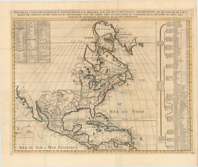
MapMaker: |
Henry Abraham Chatelain
|
|
| |
| |
Subject: |
Colonial North America |
|
| |
Period/Size: |
1720 / 18.5" x 23.4" (47.0 x 59.5 cm)
|
|
| |
Color: |
Colored
|
|
| |
Condition: |
(A) A dark impression, issued folding, with minor toning and a bit of show-through at top left of old manuscript text on verso. There are archival repairs to fold separations confined to the blank margins and a tiny hole at the fold intersection. (condition help) |
|
| |
Source: |
Atlas Historique |
|
| |
References: |
Lowery #263; Phillips (A) 579. |
|
| |
|
|
| Sales Information |
| |
| |
Price: |
|
|
| |
| |
Offered by: |
Old World Auctions |
|
| |
Catalog: |
Auction No. 170 - Antique Maps, Charts, Atlases & Globes (9468) |
|
| |
Lot/Item #: |
095 |
|
| |
| |
Date: |
11/2018
|
|
| |
| |
|