Title:
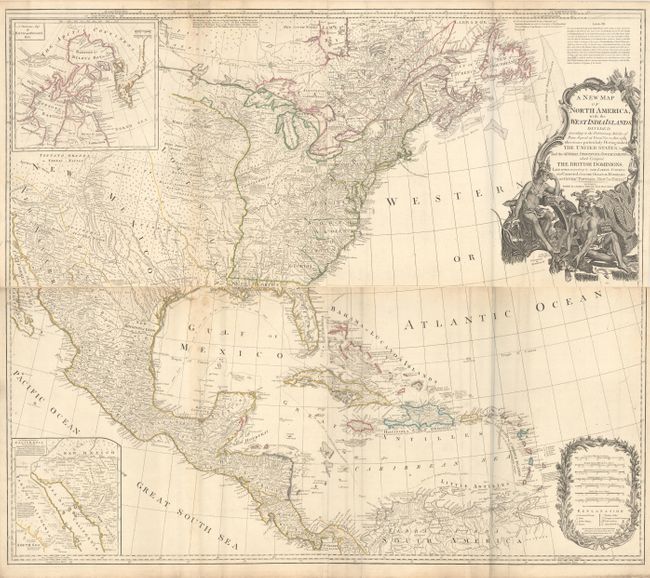
“A New Map of North America, with the West India Islands. Divided According to the Preliminary Articles of Peace, Signed at Versailles, 20, Jan. 1783…”
Map Maker:
Laurie & Whittle
This large, influential map had a long and varied ... (full text available to subscribers)
| Item Detail |
| |
| |
MapMaker: |
Laurie & Whittle
|
|
| |
| |
Subject: |
North America |
|
| |
Period/Size: |
1794 / 19.9" x 45.5" (50.6 x 115.6 cm)
|
|
| |
Color: |
Colored
|
|
| |
Condition: |
(B+) Original color with light toning along a few folds and the top edge of both sheets. On the southern sheet is a small hole in an unengraved area in the Gulf of Mexico. The primary image had been digitally merged together - the map is not fully joine (condition help) |
|
| |
Source: |
|
|
| |
References: |
Phillips (Maps) p. 865; Stevens & Tree (MCC-39) #49k. |
|
| |
|
|
| Sales Information |
| |
| |
Price: |
|
|
| |
| |
Offered by: |
Old World Auctions |
|
| |
Catalog: |
Auction No. 170 - Antique Maps, Charts, Atlases & Globes (9468) |
|
| |
Lot/Item #: |
103 |
|
| |
| |
Date: |
11/2018
|
|
| |
| |
|
Antique Maps - Valuation and Pricing, Descriptions, Resources |
|
Home |
Information |
Search |
Register |
Contact Us |
Site Map
Americana Exchange, Inc. © 1999 - 2024 Americana Exchange, Inc.. All rights reserved.
OldMaps.com, the OldMaps.com logo and
AMPR are service marks or registered service marks of Americana Exchange, Inc..
|