Title:
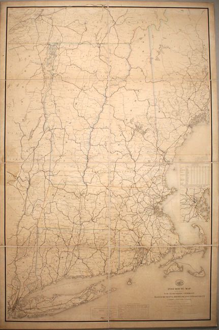
“Post Route Map of the States of New Hampshire, Vermont Massachusetts, Rhode Island, Connecticut and Parts of New York and Maine”
Map Maker:
W.L. Nicholson
This massive and detailed official postal map span... (full text available to subscribers)
| Item Detail |
| |
| |
MapMaker: |
W.L. Nicholson
|
|
| |
| |
Subject: |
New England - United States |
|
| |
Period/Size: |
1878 / 58.7" x 37.7" (149.1 x 95.8 cm)
|
|
| |
Color: |
Colored
|
|
| |
Condition: |
(B) There is light toning and offsetting, a large dampstain at left near Saratoga, and small areas of loss along some of the sections' edges, especially in Connecticut, that haven been reinstated in facsimile. Rebacked in new linen. (condition help) |
|
| |
Source: |
|
|
| |
References: |
|
|
| |
|
|
| Sales Information |
| |
| |
Price: |
|
|
| |
| |
Offered by: |
Old World Auctions |
|
| |
Catalog: |
Auction No. 170 - Antique Maps, Charts, Atlases & Globes (9468) |
|
| |
Lot/Item #: |
170 |
|
| |
| |
Date: |
11/2018
|
|
| |
| |
|
Antique Maps - Valuation and Pricing, Descriptions, Resources |
|
Home |
Information |
Search |
Register |
Contact Us |
Site Map
Americana Exchange, Inc. © 1999 - 2024 Americana Exchange, Inc.. All rights reserved.
OldMaps.com, the OldMaps.com logo and
AMPR are service marks or registered service marks of Americana Exchange, Inc..
|