| Item Detail |
| |
| |
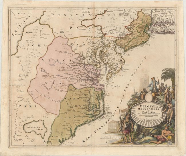
MapMaker: |
Johann Baptist Homann
|
|
| |
| |
Subject: |
Colonial Mid-Atlantic United States |
|
| |
Period/Size: |
1730 / 19.2" x 22.9" (48.8 x 58.2 cm)
|
|
| |
Color: |
Colored
|
|
| |
Condition: |
(B+) On watermarked paper with original color in the map and later color in the title cartouche. There is light scattered foxing and staining, and minor toning along the upper centerfold. (condition help) |
|
| |
Source: |
|
|
| |
References: |
Cumming (SE) #156, Williams & Johnson #7. |
|
| |
|
|
| Sales Information |
| |
| |
Price: |
|
|
| |
| |
Offered by: |
Old World Auctions |
|
| |
Catalog: |
Auction No. 170 - Antique Maps, Charts, Atlases & Globes (9468) |
|
| |
Lot/Item #: |
173 |
|
| |
| |
Date: |
11/2018
|
|
| |
| |
|