Title:
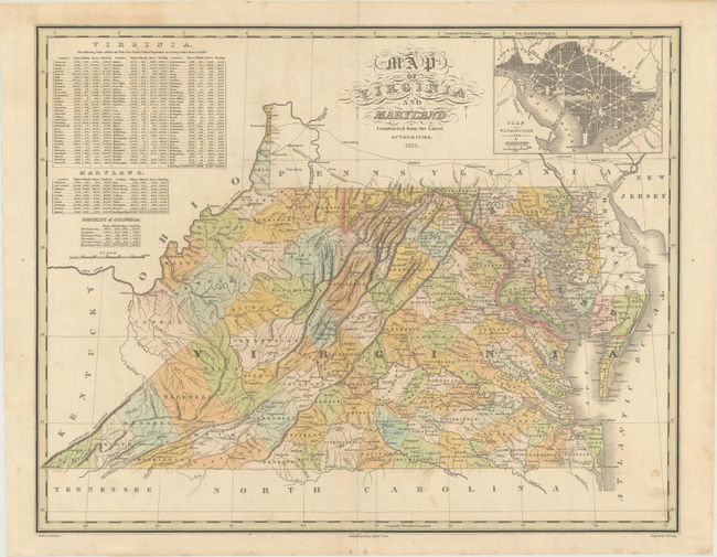
“Map of Virginia and Maryland Constructed from the Latest Authorities”
Map Maker:
Anthony Finley
This detailed map depicts counties, county seats, ... (full text available to subscribers)
| Item Detail |
| |
| |
MapMaker: |
Anthony Finley
|
|
| |
| |
Subject: |
Mid-Atlantic United States |
|
| |
Period/Size: |
1825 / 17.2" x 21.8" (43.7 x 55.4 cm)
|
|
| |
Color: |
Colored
|
|
| |
Condition: |
(B+) A nice impression with faint offsetting and minor staining. There is a short centerfold separation at top and a 3.5" separation at bottom that have both been closed on verso with archival tissue. (condition help) |
|
| |
Source: |
|
|
| |
References: |
|
|
| |
|
|
| Sales Information |
| |
| |
Price: |
|
|
| |
| |
Offered by: |
Old World Auctions |
|
| |
Catalog: |
Auction No. 170 - Antique Maps, Charts, Atlases & Globes (9468) |
|
| |
Lot/Item #: |
178 |
|
| |
| |
Date: |
11/2018
|
|
| |
| |
|
Antique Maps - Valuation and Pricing, Descriptions, Resources |
|
Home |
Information |
Search |
Register |
Contact Us |
Site Map
Americana Exchange, Inc. © 1999 - 2024 Americana Exchange, Inc.. All rights reserved.
OldMaps.com, the OldMaps.com logo and
AMPR are service marks or registered service marks of Americana Exchange, Inc..
|