| Item Detail |
| |
| |
MapMaker: |
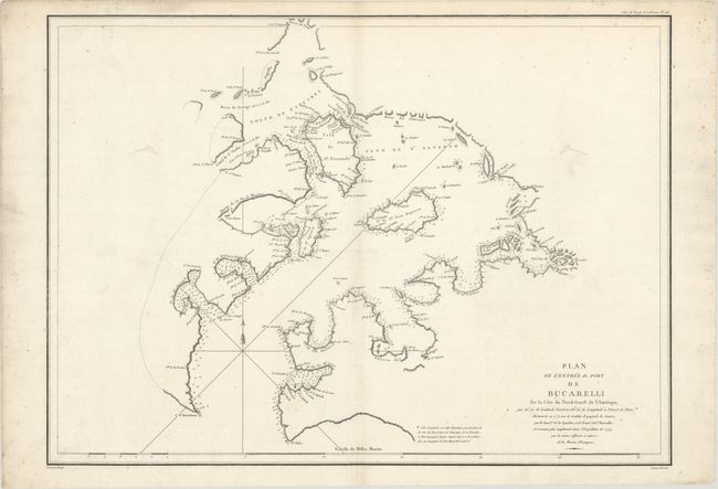
Jean Francois Galaup de La Perouse
|
|
| |
| |
Subject: |
Southeastern Alaska |
|
| |
Period/Size: |
1797 / 19.7" x 27.3" (50.1 x 69.4 cm)
|
|
| |
Color: |
Black & White
|
|
| |
Condition: |
(B+) A crisp impression on paper with a large watchtower watermark, minor toning along the centerfold, and two worm tracks in blank areas of the image at top right and left that have been professionally repaired. There is some soiling confined to the bla (condition help) |
|
| |
Source: |
Atlas du Voyage de la Perouse |
|
| |
References: |
Wagner #843; Falk #1797-12; Shirley (BL Atlases) G.LPR-1a #26. |
|
| |
|
|
| Sales Information |
| |
| |
Price: |
|
|
| |
| |
Offered by: |
Old World Auctions |
|
| |
Catalog: |
Auction No. 170 - Antique Maps, Charts, Atlases & Globes (9468) |
|
| |
Lot/Item #: |
223 |
|
| |
| |
Date: |
11/2018
|
|
| |
| |
|