Title:
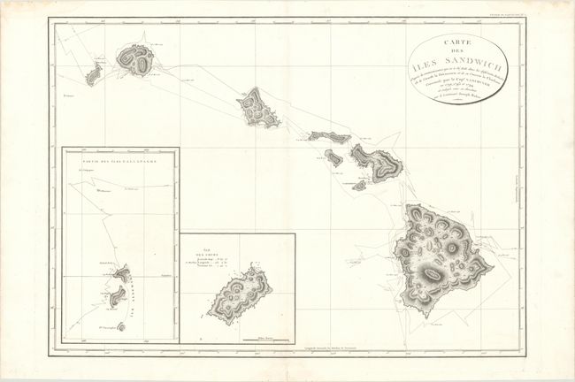
“Carte des Iles Sandwich d'Apres la Reconnoissance qui en a ete Faite dans les Differentes Relaches de la Corvelle la Decouverte et de sa Conserve le Chatham...”
Map Maker:
George Vancouver
This rare, large-scale chart of the Hawaiian Islan... (full text available to subscribers)
| Item Detail |
| |
| |
MapMaker: |
George Vancouver
|
|
| |
| |
Subject: |
Hawaii |
|
| |
Period/Size: |
1799 / 21.6" x 30.2" (54.9 x 76.7 cm)
|
|
| |
Color: |
Black & White
|
|
| |
Condition: |
(A) A dark impression on a bright sheet with a few faint dampstains almost entirely confined to the blank margins. (condition help) |
|
| |
Source: |
Voyage de Decouvertes a l' Ocean Pacifique… |
|
| |
References: |
Phillips (Atlases) #1219-2; Fitzpatrick (Early Mapping of Hawaii) plt. #21. |
|
| |
|
|
| Sales Information |
| |
| |
Price: |
|
|
| |
| |
Offered by: |
Old World Auctions |
|
| |
Catalog: |
Auction No. 170 - Antique Maps, Charts, Atlases & Globes (9468) |
|
| |
Lot/Item #: |
259 |
|
| |
| |
Date: |
11/2018
|
|
| |
| |
|
Antique Maps - Valuation and Pricing, Descriptions, Resources |
|
Home |
Information |
Search |
Register |
Contact Us |
Site Map
Americana Exchange, Inc. © 1999 - 2024 Americana Exchange, Inc.. All rights reserved.
OldMaps.com, the OldMaps.com logo and
AMPR are service marks or registered service marks of Americana Exchange, Inc..
|