Title:
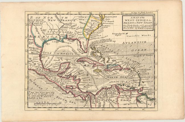
“A Map of the West-Indies &c. Mexico or New Spain. Also ye Trade Winds, and ye Several Tracts Made by ye Galeons and Flota from Place to Place”
Map Maker:
Herman Moll
Terrific copper engraved map covering the southern... (full text available to subscribers)
| Item Detail |
| |
| |
MapMaker: |
Herman Moll
|
|
| |
| |
Subject: |
Gulf of Mexico & Caribbean |
|
| |
Period/Size: |
1729 / 7.8" x 10.4" (19.9 x 26.5 cm)
|
|
| |
Color: |
Colored
|
|
| |
Condition: |
(A) A crisp impression with contemporary outline color and light toning along the edges of the sheet. (condition help) |
|
| |
Source: |
Atlas Minor |
|
| |
References: |
cf. Manasek #69. |
|
| |
|
|
| Sales Information |
| |
| |
Price: |
|
|
| |
| |
Offered by: |
Old World Auctions |
|
| |
Catalog: |
Auction No. 170 - Antique Maps, Charts, Atlases & Globes (9468) |
|
| |
Lot/Item #: |
364 |
|
| |
| |
Date: |
11/2018
|
|
| |
| |
|
Antique Maps - Valuation and Pricing, Descriptions, Resources |
|
Home |
Information |
Search |
Register |
Contact Us |
Site Map
Americana Exchange, Inc. © 1999 - 2024 Americana Exchange, Inc.. All rights reserved.
OldMaps.com, the OldMaps.com logo and
AMPR are service marks or registered service marks of Americana Exchange, Inc..
|