| Item Detail |
| |
| |
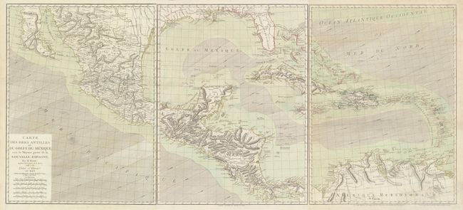
MapMaker: |
Rigobert Bonne
|
|
| |
| |
Subject: |
Gulf of Mexico & Caribbean |
|
| |
Period/Size: |
1786 / 25.9" x 19.5" (65.8 x 49.6 cm)
|
|
| |
Color: |
Colored
|
|
| |
Condition: |
(B+) Fine impression and original color with full wide margins. Folded, as issued. There are a couple of faint damp stains, including a small one adjacent to the title cartouche and a larger one just entering Venezuela at bottom right, as well as some m (condition help) |
|
| |
Source: |
|
|
| |
References: |
Sellers & Van Ee #1703; cf. Lowery #648. |
|
| |
|
|
| Sales Information |
| |
| |
Price: |
|
|
| |
| |
Offered by: |
Old World Auctions |
|
| |
Catalog: |
Auction No. 170 - Antique Maps, Charts, Atlases & Globes (9468) |
|
| |
Lot/Item #: |
365 |
|
| |
| |
Date: |
11/2018
|
|
| |
| |
|