Title:
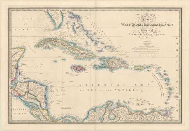
“Map of the West India & Bahama Islands with the Adjacent Coasts of Yucatan, Honduras, Caracas &c.”
Map Maker:
James Wyld
This elegantly engraved, large-scale map covers al... (full text available to subscribers)
| Item Detail |
| |
| |
MapMaker: |
James Wyld
|
|
| |
| |
Subject: |
Caribbean |
|
| |
Period/Size: |
1840 / 20.6" x 30.6" (52.4 x 77.8 cm)
|
|
| |
Color: |
Colored
|
|
| |
Condition: |
(A) Fine original color on a bright sheet with a couple of repaired tears in bottom margin that do not affect the map. The faint shadow along the centerfold is caused by the scanner, and does not appear on the map itself. (condition help) |
|
| |
Source: |
|
|
| |
References: |
|
|
| |
|
|
| Sales Information |
| |
| |
Price: |
|
|
| |
| |
Offered by: |
Old World Auctions |
|
| |
Catalog: |
Auction No. 170 - Antique Maps, Charts, Atlases & Globes (9468) |
|
| |
Lot/Item #: |
372 |
|
| |
| |
Date: |
11/2018
|
|
| |
| |
|
Antique Maps - Valuation and Pricing, Descriptions, Resources |
|
Home |
Information |
Search |
Register |
Contact Us |
Site Map
Americana Exchange, Inc. © 1999 - 2024 Americana Exchange, Inc.. All rights reserved.
OldMaps.com, the OldMaps.com logo and
AMPR are service marks or registered service marks of Americana Exchange, Inc..
|