Title:
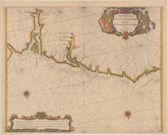
“De Cust van Westindien, Tusschen Rio Demerary, en Rio d'Oronoque”
Map Maker:
Roggeveen [Family]
This rare map is the first Dutch sea chart devoted... (full text available to subscribers)
| Item Detail |
| |
| |
MapMaker: |
Roggeveen [Family]
|
|
| |
| |
Subject: |
Guyana |
|
| |
Period/Size: |
1685 / 16.1" x 20.1" (40.9 x 51.1 cm)
|
|
| |
Color: |
Colored
|
|
| |
Condition: |
(A) Minor printer's ink residue with a hint of toning and a faint damp stain along the bottom edge of the sheet. (condition help) |
|
| |
Source: |
Het Eerste Deel Van het Brandende Veenģ |
|
| |
References: |
Shirley (BL Atlases) M.ROG-1b. |
|
| |
|
|
| Sales Information |
| |
| |
Price: |
|
|
| |
| |
Offered by: |
Old World Auctions |
|
| |
Catalog: |
Auction No. 170 - Antique Maps, Charts, Atlases & Globes (9468) |
|
| |
Lot/Item #: |
417 |
|
| |
| |
Date: |
11/2018
|
|
| |
| |
|
Antique Maps - Valuation and Pricing, Descriptions, Resources |
|
Home |
Information |
Search |
Register |
Contact Us |
Site Map
Americana Exchange, Inc. © 1999 - 2024 Americana Exchange, Inc.. All rights reserved.
OldMaps.com, the OldMaps.com logo and
AMPR are service marks or registered service marks of Americana Exchange, Inc..
|