Title:
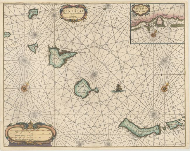
“Pascaarte voor een Gedeelte der Canarise Eylanden, als Canaria, Tenerisa, Forteventura Etc.”
Map Maker:
Jacobsz [Family]
This rare, attractive sea chart depicts the Canary... (full text available to subscribers)
| Item Detail |
| |
| |
MapMaker: |
Jacobsz [Family]
|
|
| |
| |
Subject: |
Canary Islands |
|
| |
Period/Size: |
1654 / 16.9" x 21.1" (43.0 x 53.6 cm)
|
|
| |
Color: |
Colored
|
|
| |
Condition: |
(B+) An excellent, dark impression on a clean, bright sheet. There are some short tears along the edges of the sheet that have been archivally repaired, with a couple entering the map image less than 1". (condition help) |
|
| |
Source: |
|
|
| |
References: |
|
|
| |
|
|
| Sales Information |
| |
| |
Price: |
|
|
| |
| |
Offered by: |
Old World Auctions |
|
| |
Catalog: |
Auction No. 170 - Antique Maps, Charts, Atlases & Globes (9468) |
|
| |
Lot/Item #: |
431 |
|
| |
| |
Date: |
11/2018
|
|
| |
| |
|
Antique Maps - Valuation and Pricing, Descriptions, Resources |
|
Home |
Information |
Search |
Register |
Contact Us |
Site Map
Americana Exchange, Inc. © 1999 - 2024 Americana Exchange, Inc.. All rights reserved.
OldMaps.com, the OldMaps.com logo and
AMPR are service marks or registered service marks of Americana Exchange, Inc..
|