| Item Detail |
| |
| |
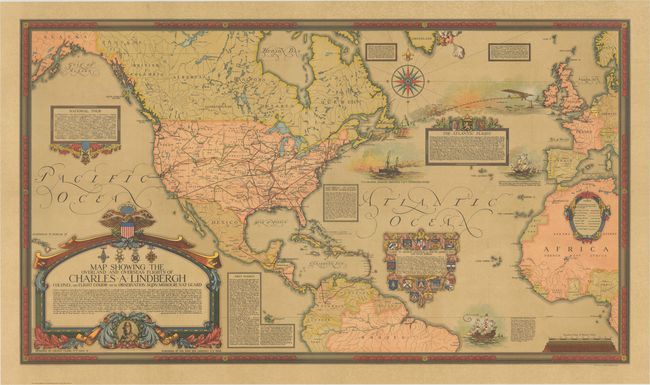
MapMaker: |
Ernest Clegg
|
|
| |
| |
Subject: |
North America & North Atlantic |
|
| |
Period/Size: |
1928 / 26.2" x 46.1" (66.6 x 117.1 cm)
|
|
| |
Color: |
Colored
|
|
| |
Condition: |
(A) Issued folding with a few tiny holes at fold intersections. The separate front cover is toned with a few spots of foxing and a couple of archivally repaired tears. (condition help) |
|
| |
Source: |
|
|
| |
References: |
|
|
| |
|
|
| Sales Information |
| |
| |
Price: |
|
|
| |
| |
Offered by: |
Old World Auctions |
|
| |
Catalog: |
Auction No. 170 - Antique Maps, Charts, Atlases & Globes (9468) |
|
| |
Lot/Item #: |
434 |
|
| |
| |
Date: |
11/2018
|
|
| |
| |
|