Title:
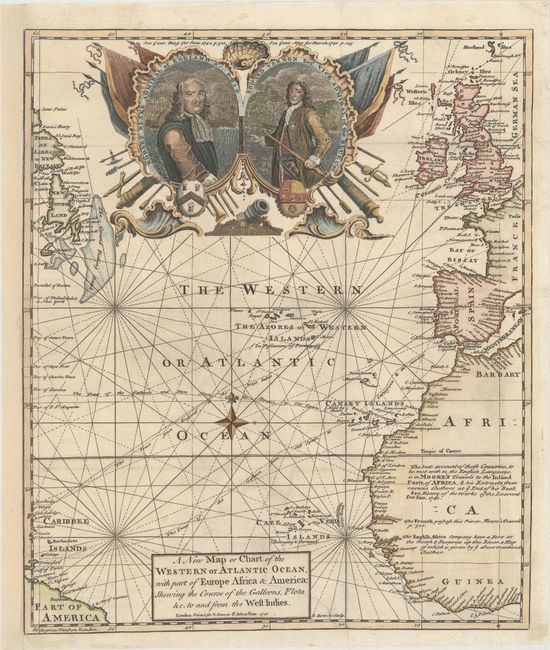
“A New Map or Chart of the Western or Atlantic Ocean, with Part of Europe Africa & America: Shewing the Course of the Galleons, Flota &c. to and from the West Indies”
Map Maker:
Emanuel Bowen
This handsome map of the Atlantic illustrates the ... (full text available to subscribers)
| Item Detail |
| |
| |
MapMaker: |
Emanuel Bowen
|
|
| |
| |
Subject: |
North Atlantic |
|
| |
Period/Size: |
1740 / 13.8" x 11.6" (35.1 x 29.5 cm)
|
|
| |
Color: |
Colored
|
|
| |
Condition: |
(B+) Issued folding on watermarked paper with a binding trim at bottom right replaced with old paper and an associated 5" binding tear that has been professionally repaired on verso. Remargined at left with a tiny portion of the border redrawn in facsimi (condition help) |
|
| |
Source: |
Gentleman's Magazine |
|
| |
References: |
Jolly #GENT-14. |
|
| |
|
|
| Sales Information |
| |
| |
Price: |
|
|
| |
| |
Offered by: |
Old World Auctions |
|
| |
Catalog: |
Auction No. 170 - Antique Maps, Charts, Atlases & Globes (9468) |
|
| |
Lot/Item #: |
437 |
|
| |
| |
Date: |
11/2018
|
|
| |
| |
|
Antique Maps - Valuation and Pricing, Descriptions, Resources |
|
Home |
Information |
Search |
Register |
Contact Us |
Site Map
Americana Exchange, Inc. © 1999 - 2024 Americana Exchange, Inc.. All rights reserved.
OldMaps.com, the OldMaps.com logo and
AMPR are service marks or registered service marks of Americana Exchange, Inc..
|