| Item Detail |
| |
| |
MapMaker: |
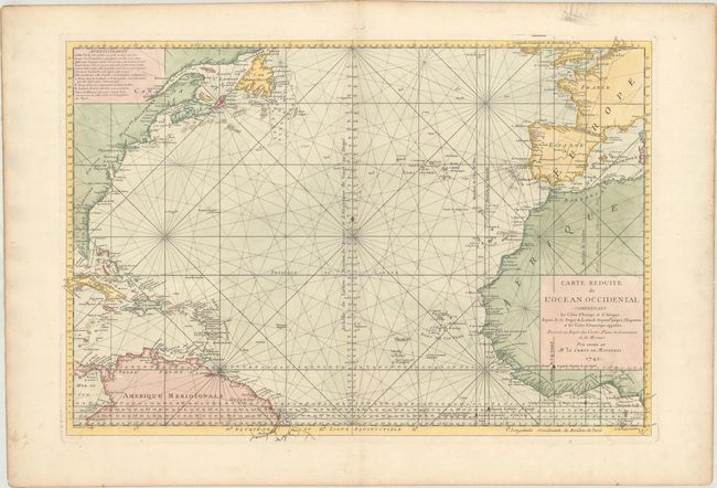
Depot de la Marine
|
|
| |
| |
Subject: |
North Atlantic |
|
| |
Period/Size: |
1742 / 21.3" x 31.2" (54.1 x 79.3 cm)
|
|
| |
Color: |
Colored
|
|
| |
Condition: |
(A) Excellent impression and color on a bright, watermarked sheet with wide margins and an area of printer's ink residue adjacent to Portugal. There is minor marginal soiling and light toning along the edges of the sheet. (condition help) |
|
| |
Source: |
|
|
| |
References: |
|
|
| |
|
|
| Sales Information |
| |
| |
Price: |
|
|
| |
| |
Offered by: |
Old World Auctions |
|
| |
Catalog: |
Auction No. 170 - Antique Maps, Charts, Atlases & Globes (9468) |
|
| |
Lot/Item #: |
439 |
|
| |
| |
Date: |
11/2018
|
|
| |
| |
|