| Item Detail |
| |
| |
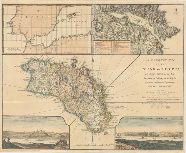
MapMaker: |
Laurie & Whittle
|
|
| |
| |
Subject: |
Menorca, Balearic Islands, Spain |
|
| |
Period/Size: |
1794 / 17.3" x 21.4" (44.0 x 54.4 cm)
|
|
| |
Color: |
Colored
|
|
| |
Condition: |
(B+) A nice impression with a short tear, a small chip in the inset at top left, and some separations along the centerfold, all of which have been closed on verso with archival materials. (condition help) |
|
| |
Source: |
A New Universal Atlas Exhibiting All the Empires... |
|
| |
References: |
Phillips (Atlases) #3534-23; Shirley (BL Atlases) T.LAU-1c #20. |
|
| |
|
|
| Sales Information |
| |
| |
Price: |
|
|
| |
| |
Offered by: |
Old World Auctions |
|
| |
Catalog: |
Auction No. 170 - Antique Maps, Charts, Atlases & Globes (9468) |
|
| |
Lot/Item #: |
519 |
|
| |
| |
Date: |
11/2018
|
|
| |
| |
|