Title:
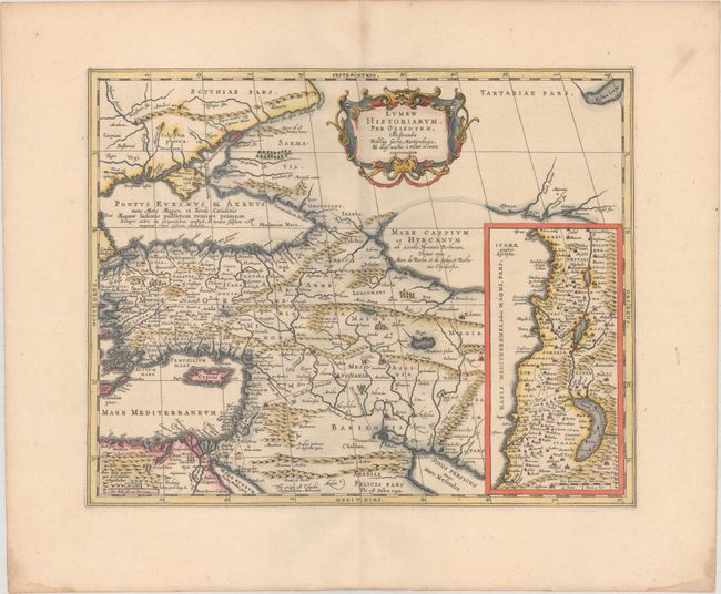
“Lumen Historiarum. Per Orientem, Illustrandis Biblijs Sacris, Martijrologio, & Alijs Multis a Fran. Hareio Concinnatum”
Map Maker:
Jan Jansson
Beautifully engraved map of the region from the ea... (full text available to subscribers)
| Item Detail |
| |
| |
MapMaker: |
Jan Jansson
|
|
| |
| |
Subject: |
Eastern Mediterranean & Middle East |
|
| |
Period/Size: |
1741 / 14.9" x 18.6" (37.9 x 47.3 cm)
|
|
| |
Color: |
Colored
|
|
| |
Condition: |
(A) A sharp impression on a clean sheet with wide margins and minor toning and soiling along the edges of the sheet. (condition help) |
|
| |
Source: |
Description Exacte de l'Univers, ou l'Ancienne Geographie Sacree et Profane |
|
| |
References: |
Laor #323; Van der Krogt (Vol. I) #0821H:1. |
|
| |
|
|
| Sales Information |
| |
| |
Price: |
|
|
| |
| |
Offered by: |
Old World Auctions |
|
| |
Catalog: |
Auction No. 170 - Antique Maps, Charts, Atlases & Globes (9468) |
|
| |
Lot/Item #: |
604 |
|
| |
| |
Date: |
11/2018
|
|
| |
| |
|
Antique Maps - Valuation and Pricing, Descriptions, Resources |
|
Home |
Information |
Search |
Register |
Contact Us |
Site Map
Americana Exchange, Inc. © 1999 - 2024 Americana Exchange, Inc.. All rights reserved.
OldMaps.com, the OldMaps.com logo and
AMPR are service marks or registered service marks of Americana Exchange, Inc..
|