| Item Detail |
| |
| |
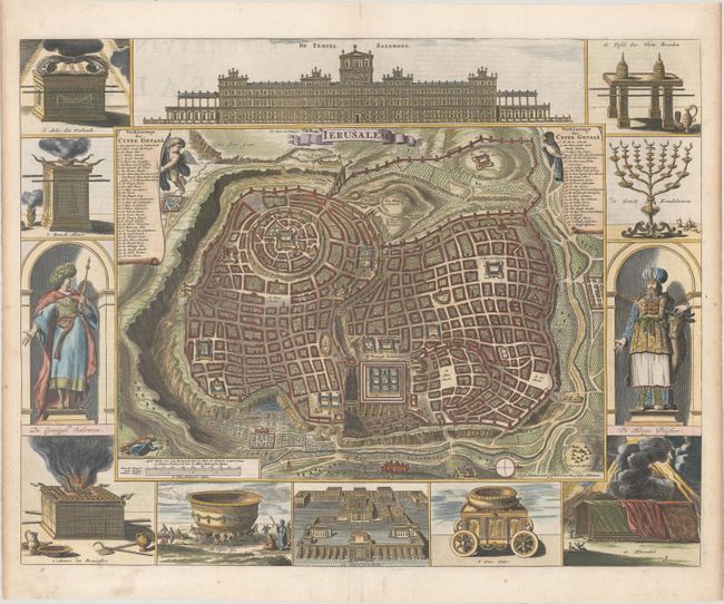
MapMaker: |
Bastiaan Stoopendaal
|
|
| |
| |
Subject: |
Jerusalem, Holy Land |
|
| |
Period/Size: |
1686 / 14.3" x 18.2" (36.4 x 46.3 cm)
|
|
| |
Color: |
Colored
|
|
| |
Condition: |
(A) A crisp impression with a professionally repaired centerfold separation that enters 2" into image at bottom and light toning along the edges of the sheet. (condition help) |
|
| |
Source: |
|
|
| |
References: |
Poortman & Augusteijn #133 GI; cf. Laor #1150. |
|
| |
|
|
| Sales Information |
| |
| |
Price: |
|
|
| |
| |
Offered by: |
Old World Auctions |
|
| |
Catalog: |
Auction No. 170 - Antique Maps, Charts, Atlases & Globes (9468) |
|
| |
Lot/Item #: |
616 |
|
| |
| |
Date: |
11/2018
|
|
| |
| |
|