Title:
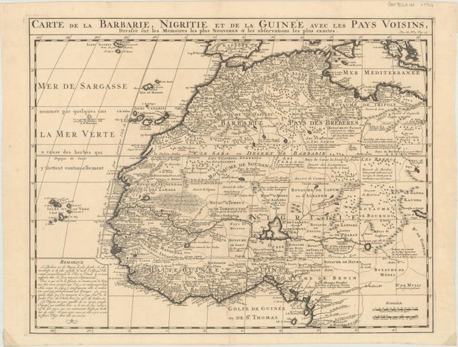
“Carte de la Barbarie, Nigritie et de la Guinee avec les Pays Voisins, Dressee sur les Memoires les Plus Nouveaux & les Observations les Plus Exactes”
Map Maker:
Henry Abraham Chatelain
This great map of western Africa is based on Guill... (full text available to subscribers)
| Item Detail |
| |
| |
MapMaker: |
Henry Abraham Chatelain
|
|
| |
| |
Subject: |
Northwestern Africa |
|
| |
Period/Size: |
1710 / 15.8" x 20.2" (40.2 x 51.3 cm)
|
|
| |
Color: |
Black & White
|
|
| |
Condition: |
(B+) A dark impression on paper with a Strasburg Lily watermark, a light stain and two small abrasions around the centerfold at bottom, and a short centerfold separation that just enters the neatline at bottom. There are small pieces of cello tape in the (condition help) |
|
| |
Source: |
|
|
| |
References: |
|
|
| |
|
|
| Sales Information |
| |
| |
Price: |
|
|
| |
| |
Offered by: |
Old World Auctions |
|
| |
Catalog: |
Auction No. 170 - Antique Maps, Charts, Atlases & Globes (9468) |
|
| |
Lot/Item #: |
669 |
|
| |
| |
Date: |
11/2018
|
|
| |
| |
|
Antique Maps - Valuation and Pricing, Descriptions, Resources |
|
Home |
Information |
Search |
Register |
Contact Us |
Site Map
Americana Exchange, Inc. © 1999 - 2024 Americana Exchange, Inc.. All rights reserved.
OldMaps.com, the OldMaps.com logo and
AMPR are service marks or registered service marks of Americana Exchange, Inc..
|