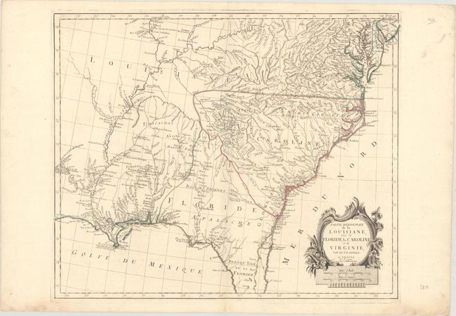
Title:
“Partie Meridionale de la Louisiane, avec la Floride, la Caroline et la Virginie”
Map Maker:
Anville/Santini
This is an interesting Italian version of D'Anvill... (full text available to subscribers)
| Item Detail |
| |
| |
MapMaker: |
Anville/Santini
|
|
| |
| |
Subject: |
Colonial Southern United States |
|
| |
Period/Size: |
1784 / 18.9" x 22.8" (48.0 x 58.0 cm)
|
|
| |
Color: |
Colored
|
|
| |
Condition: |
(A) Original outline color on watermarked paper with a few tiny edge tears and one small chip all confined to the bottom blank margin. (condition help) |
|
| |
Source: |
Atlas Universel |
|
| |
References: |
Phillips (Atlases) #647-48; Sellers and Van Ee #1408. |
|
| |
|
|
| Sales Information |
| |
| |
Price: |
|
|
| |
| |
Offered by: |
Old World Auctions |
|
| |
Catalog: |
Auction No. 170 - Antique Maps, Charts, Atlases & Globes (9468) |
|
| |
Lot/Item #: |
192 |
|
| |
| |
Date: |
11/2018
|
|
| |
| |
|
Antique Maps - Valuation and Pricing, Descriptions, Resources |
|
Home |
Information |
Search |
Register |
Contact Us |
Site Map
Americana Exchange, Inc. © 1999 - 2024 Americana Exchange, Inc.. All rights reserved.
OldMaps.com, the OldMaps.com logo and
AMPR are service marks or registered service marks of Americana Exchange, Inc..
|