Title:
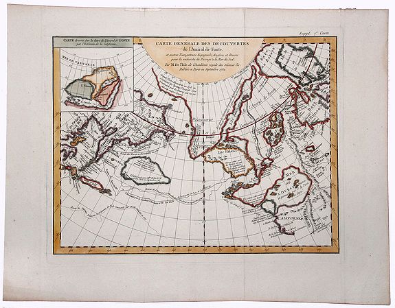
“Carte Generale des Decouvertes de l'Amiral de Fonte et Autres Navigateurs Espagnols Anglois et Russes…”
Map Maker:
Didier Robert de Vaugondy
An extremely interesting map of the Northwest Coas... (full text available to subscribers)
| Item Detail |
| |
| |
MapMaker: |
Didier Robert de Vaugondy
|
|
| |
| |
Subject: |
North Pacific Ocean New data: North America |
|
| |
Period/Size: |
1772 / 12.3" x 15.4" (31.3 x 39.2 cm)
|
|
| |
Color: |
Colored
|
|
| |
Condition: |
In very good condition except for some very small repairs for small tears in top margin. Folds as issued. Wide margins. (condition help) |
|
| |
Source: |
|
|
| |
References: |
|
|
| |
|
|
| Sales Information |
| |
| |
Price: |
|
|
| |
| |
Offered by: |
Paulus Swaen Old Maps & Prints |
|
| |
Catalog: |
October 15, 2019 Internet Auction (9473) |
|
| |
Lot/Item #: |
83185 |
|
| |
| |
Date: |
10/2019
|
|
| |
| |
|
Antique Maps - Valuation and Pricing, Descriptions, Resources |
|
Home |
Information |
Search |
Register |
Contact Us |
Site Map
Americana Exchange, Inc. © 1999 - 2024 Americana Exchange, Inc.. All rights reserved.
OldMaps.com, the OldMaps.com logo and
AMPR are service marks or registered service marks of Americana Exchange, Inc..
|