Title:
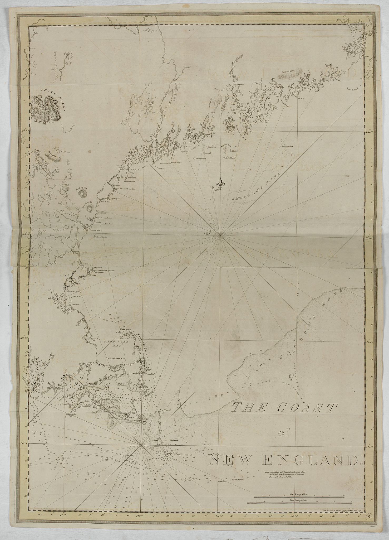
“The Coast of New England”
Map Maker:
Joseph Frederick Wallet Des Barres
A chart of New England Coast, taken from the "Atla... (full text available to subscribers)
| Item Detail |
| |
| |
MapMaker: |
Joseph Frederick Wallet Des Barres
|
|
| |
| |
Subject: |
New England - United States New data: New England states / V |
|
| |
Period/Size: |
1776 / 41.5" x 29.3" (105.5 x 74.5 cm)
|
|
| |
Color: |
Black & White
|
|
| |
Condition: |
Paper slightly age-toned. Folds as issued. Dark impression on thick paper, bearing "LVG" watermark. Yellow border. (condition help) |
|
| |
Source: |
Atlantic Neptune |
|
| |
References: |
|
|
| |
|
|
| Sales Information |
| |
| |
Price: |
|
|
| |
| |
Offered by: |
Paulus Swaen Old Maps & Prints |
|
| |
Catalog: |
October 15, 2019 Internet Auction (9473) |
|
| |
Lot/Item #: |
44822 |
|
| |
| |
Date: |
10/2019
|
|
| |
| |
|
Antique Maps - Valuation and Pricing, Descriptions, Resources |
|
Home |
Information |
Search |
Register |
Contact Us |
Site Map
Americana Exchange, Inc. © 1999 - 2024 Americana Exchange, Inc.. All rights reserved.
OldMaps.com, the OldMaps.com logo and
AMPR are service marks or registered service marks of Americana Exchange, Inc..
|