Title:
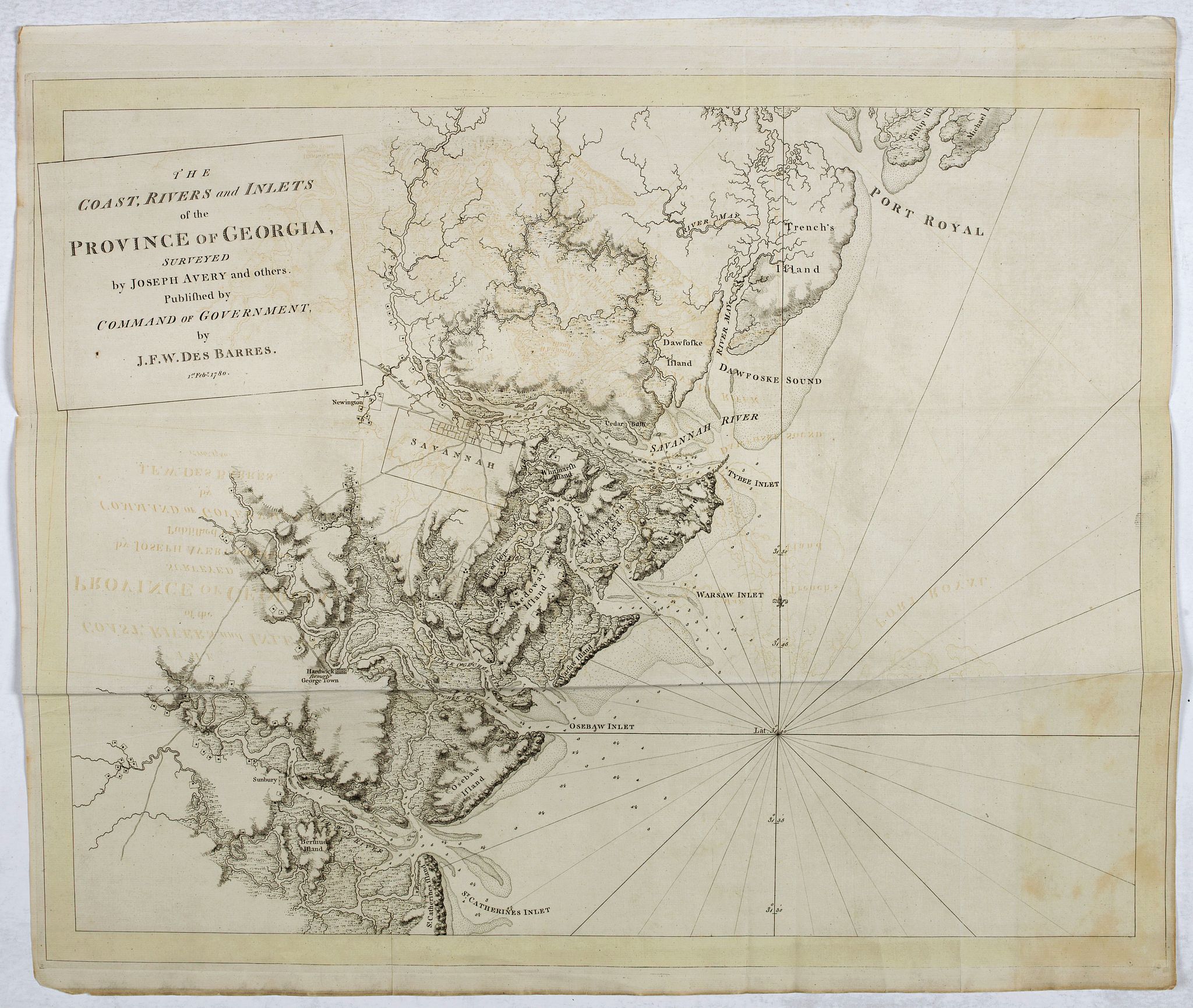
“The coast, rivers and inlets of the Province of Georgia surveyed by Joseph Avery and others. . .”
Map Maker:
Joseph Frederick Wallet Des Barres
Chart of part of the Eastern Seaboard of the USA, ... (full text available to subscribers)
| Item Detail |
| |
| |
MapMaker: |
Joseph Frederick Wallet Des Barres
|
|
| |
| |
Subject: |
Georgia New data: Virginia/ Maryland/ Carolina / Georgia |
|
| |
Period/Size: |
1780 / 23.2" x 29.4" (59.0 x 74.7 cm)
|
|
| |
Color: |
Black & White
|
|
| |
Condition: |
Paper slightly age-toned. Folds as issued. Dark impression on thick paper, with JBATES water mark. Yellow border. (condition help) |
|
| |
Source: |
Atlantic Neptune |
|
| |
References: |
|
|
| |
|
|
| Sales Information |
| |
| |
Price: |
|
|
| |
| |
Offered by: |
Paulus Swaen Old Maps & Prints |
|
| |
Catalog: |
October 15, 2019 Internet Auction (9473) |
|
| |
Lot/Item #: |
44819 |
|
| |
| |
Date: |
10/2019
|
|
| |
| |
|
Antique Maps - Valuation and Pricing, Descriptions, Resources |
|
Home |
Information |
Search |
Register |
Contact Us |
Site Map
Americana Exchange, Inc. © 1999 - 2024 Americana Exchange, Inc.. All rights reserved.
OldMaps.com, the OldMaps.com logo and
AMPR are service marks or registered service marks of Americana Exchange, Inc..
|