Rister or Sign In to see pricing information


Title:

Chart of the N.W. Coast of America and N.E. Coast of Asia explored in the Years 1778 & 1779. . .

Map Maker:

James Cook

Chart of the N.W. Coast of America and N.E. Coast of Asia explored in the Years 1778 & 1779. . .

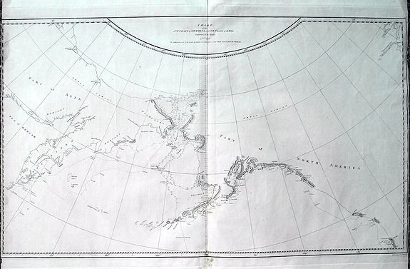
A scarce edition of Captain James Cook's discoveri... (full text available to subscribers)
Item Detail
 
  MapMaker:  

James Cook


  Subject:  North Pacific Ocean New data: Alaska  
  Period/Size:  c. 1784 / 15.4" x 26.2"  (39.2 x 66.6 cm)  
  Color:  Black & White  
  Condition:  A nice example with good print on heavy hand-laid paper. Large watermarks inside visible when held against the light. Repaired marginal splits to top and bottom fold. Some light spotting. Very small margins to the sides - just cut outside of borderline. (condition help)  
  Source:   
  References:  Kershaw 1140. Wagner 696.  
 
 
Sales Information
 
  Price: 

Please register your email to view records, or sign in with email address to see records


  Offered by:  Paulus Swaen Old Maps & Prints  
  Catalog:  October 15, 2019 Internet Auction (9473)  
  Lot/Item #:  83158  
 
  Date:  10/2019  


Antique Maps - Valuation and Pricing, Descriptions, Resources


Home | Information | Search | Register | Contact Us | Site Map

Americana Exchange, Inc. © 1999 - 2024 Americana Exchange, Inc.. All rights reserved. OldMaps.com, the OldMaps.com logo and
AMPR are service marks or registered service marks of Americana Exchange, Inc..