Title:
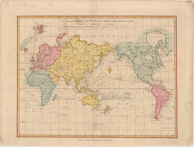
“A General Chart of the World on Mercators Projection Exhibiting All the New Discoveries and the Tracks, of the Different Circum Navigators”
Map Maker:
Samuel John Neele
This chart of the world outlines the tracks of Cap... (full text available to subscribers)
| Item Detail |
| |
| |
MapMaker: |
Samuel John Neele
|
|
| |
| |
Subject: |
World |
|
| |
Period/Size: |
1808 / 13.2" x 17.3" (33.6 x 44.0 cm)
|
|
| |
Color: |
Colored
|
|
| |
Condition: |
(B+) There is faint toning, minor foxing mostly confined to the blank margin, and a 3.5" tear in the bottom left corner that has been closed on verso with archival tape. (condition help) |
|
| |
Source: |
|
|
| |
References: |
|
|
| |
|
|
| Sales Information |
| |
| |
Price: |
|
|
| |
| |
Offered by: |
Old World Auctions |
|
| |
Catalog: |
Auction No. 171 - Antique Maps, Charts, Atlases & Globes (9469) |
|
| |
Lot/Item #: |
35 |
|
| |
| |
Date: |
02/2019
|
|
| |
| |
|
Antique Maps - Valuation and Pricing, Descriptions, Resources |
|
Home |
Information |
Search |
Register |
Contact Us |
Site Map
Americana Exchange, Inc. © 1999 - 2024 Americana Exchange, Inc.. All rights reserved.
OldMaps.com, the OldMaps.com logo and
AMPR are service marks or registered service marks of Americana Exchange, Inc..
|