| Item Detail |
| |
| |
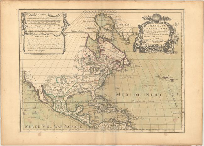
MapMaker: |
Guillaume Delisle
|
|
| |
| |
Subject: |
Colonial North America |
|
| |
Period/Size: |
1700 / 17.9" x 23.8" (45.5 x 60.5 cm)
|
|
| |
Color: |
Colored
|
|
| |
Condition: |
(B+) A nice impression on watermarked paper with original wash and outline color. There are a few small stains in the bottom corners, an archivally repaired centerfold separation confined to the bottom blank margin, a crease adjacent to the centerfold, a (condition help) |
|
| |
Source: |
|
|
| |
References: |
Mercator's World Vol. 6, No. 4, pp. 44-49; Tooley (Amer) p. 19, #30; Wheat [TMW] #79; Burden #761. |
|
| |
|
|
| Sales Information |
| |
| |
Price: |
|
|
| |
| |
Offered by: |
Old World Auctions |
|
| |
Catalog: |
Auction No. 171 - Antique Maps, Charts, Atlases & Globes (9469) |
|
| |
Lot/Item #: |
95 |
|
| |
| |
Date: |
02/2019
|
|
| |
| |
|