Title:
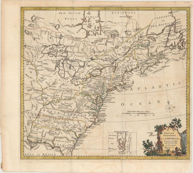
“British Dominions in America, Drawn from the Latest and Best Authorities”
Map Maker:
Thomas Kitchin
This handsome colonial period map covers the area ... (full text available to subscribers)
| Item Detail |
| |
| |
MapMaker: |
Thomas Kitchin
|
|
| |
| |
Subject: |
Colonial Eastern United States & Canada |
|
| |
Period/Size: |
1780 / 13.4" x 14.8" (34.1 x 37.6 cm)
|
|
| |
Color: |
Colored
|
|
| |
Condition: |
(B+) Issued folding on paper with the watermark of a horn coat of arms and the initials "GR." There is minor offsetting and toning and some short fold separations that have been repaired with archival materials on verso. (condition help) |
|
| |
Source: |
Guthrie's New System of Modern Geography... |
|
| |
References: |
McCorkle #780.6; Goss (NA) #64. |
|
| |
|
|
| Sales Information |
| |
| |
Price: |
|
|
| |
| |
Offered by: |
Old World Auctions |
|
| |
Catalog: |
Auction No. 171 - Antique Maps, Charts, Atlases & Globes (9469) |
|
| |
Lot/Item #: |
126 |
|
| |
| |
Date: |
02/2019
|
|
| |
| |
|
Antique Maps - Valuation and Pricing, Descriptions, Resources |
|
Home |
Information |
Search |
Register |
Contact Us |
Site Map
Americana Exchange, Inc. © 1999 - 2024 Americana Exchange, Inc.. All rights reserved.
OldMaps.com, the OldMaps.com logo and
AMPR are service marks or registered service marks of Americana Exchange, Inc..
|