| Item Detail |
| |
| |
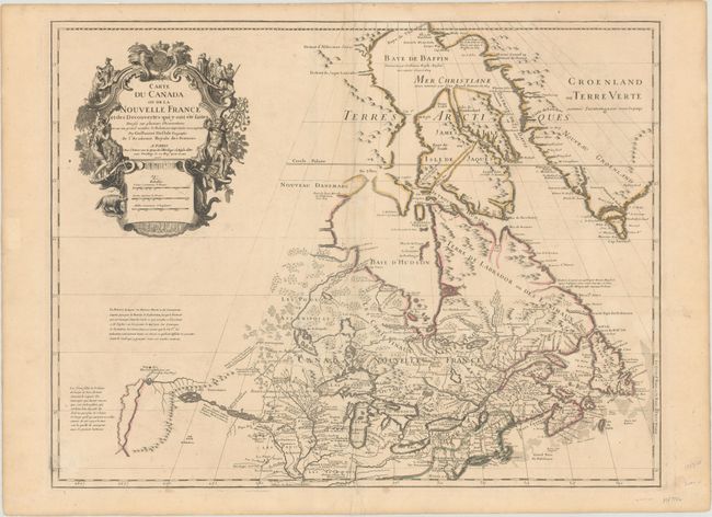
MapMaker: |
Guillaume Delisle
|
|
| |
| |
Subject: |
Colonial Northeastern United States & Canada, Great Lakes |
|
| |
Period/Size: |
1703 / 19.6" x 25.6" (49.8 x 65.1 cm)
|
|
| |
Color: |
Colored
|
|
| |
Condition: |
(B+) Watermarked paper with very light toning and soiling. There are a couple of minor creases and a tear that extends 1/2" into image at bottom center that has been archivally repaired on verso. (condition help) |
|
| |
Source: |
|
|
| |
References: |
Kershaw #311; cf. Schwartz & Ehrenberg p. 135-137, Plt. 80; Tooley (Amer), p. 20, #37. |
|
| |
|
|
| Sales Information |
| |
| |
Price: |
|
|
| |
| |
Offered by: |
Old World Auctions |
|
| |
Catalog: |
Auction No. 171 - Antique Maps, Charts, Atlases & Globes (9469) |
|
| |
Lot/Item #: |
130 |
|
| |
| |
Date: |
02/2019
|
|
| |
| |
|