Title:
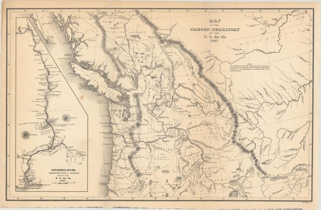
“Map of the Oregon Territory by the U.S. Ex. Ex.”
Map Maker:
Charles Wilkes
This is a reduced version of one of the most detai... (full text available to subscribers)
| Item Detail |
| |
| |
MapMaker: |
Charles Wilkes
|
|
| |
| |
Subject: |
Northwestern United States & Canada |
|
| |
Period/Size: |
1841 / 8.2" x 13.1" (20.9 x 33.3 cm)
|
|
| |
Color: |
Black & White
|
|
| |
Condition: |
(B+) Issued folding with a couple minor spots and light toning mostly confined to the sheet's edges. A couple short fold separations at top and a short edge tear at bottom left have been closed on verso with archival tape. (condition help) |
|
| |
Source: |
Narrative of the United States Exploring Expeditionģ |
|
| |
References: |
cf. Wheat (TMW) #457. |
|
| |
|
|
| Sales Information |
| |
| |
Price: |
|
|
| |
| |
Offered by: |
Old World Auctions |
|
| |
Catalog: |
Auction No. 171 - Antique Maps, Charts, Atlases & Globes (9469) |
|
| |
Lot/Item #: |
137 |
|
| |
| |
Date: |
02/2019
|
|
| |
| |
|
Antique Maps - Valuation and Pricing, Descriptions, Resources |
|
Home |
Information |
Search |
Register |
Contact Us |
Site Map
Americana Exchange, Inc. © 1999 - 2024 Americana Exchange, Inc.. All rights reserved.
OldMaps.com, the OldMaps.com logo and
AMPR are service marks or registered service marks of Americana Exchange, Inc..
|