| Item Detail |
| |
| |
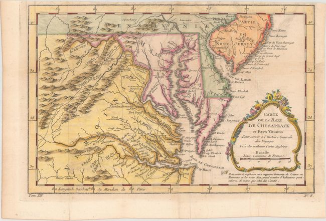
MapMaker: |
Jacques Nicolas Bellin
|
|
| |
| |
Subject: |
Colonial Mid-Atlantic United States |
|
| |
Period/Size: |
1757 / 7.4" x 11.3" (18.8 x 28.7 cm)
|
|
| |
Color: |
Colored
|
|
| |
Condition: |
(B+) Issued folding on watermarked paper with light offsetting, faint damp stains, and a binding trim at top right that has been replaced with old paper. (condition help) |
|
| |
Source: |
Prevost's Histoire Generale des Voyages |
|
| |
References: |
Sellers & Van Ee #1383; cf. Tooley (MCC-96) #875. |
|
| |
|
|
| Sales Information |
| |
| |
Price: |
|
|
| |
| |
Offered by: |
Old World Auctions |
|
| |
Catalog: |
Auction No. 171 - Antique Maps, Charts, Atlases & Globes (9469) |
|
| |
Lot/Item #: |
171 |
|
| |
| |
Date: |
02/2019
|
|
| |
| |
|