| Item Detail |
| |
| |
MapMaker: |
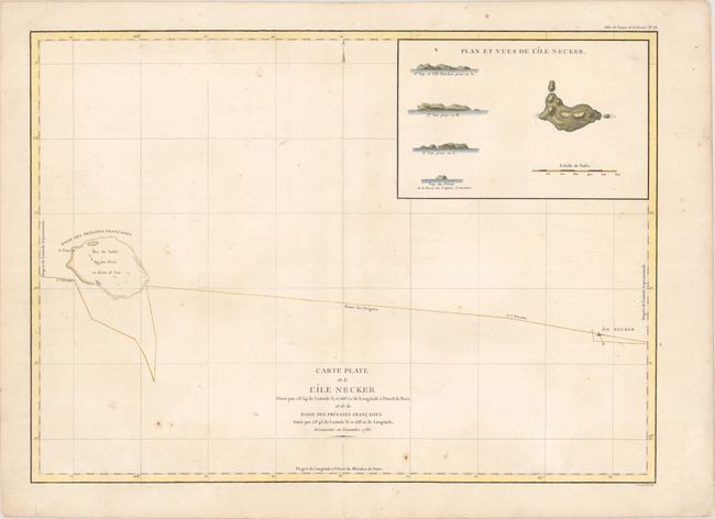
Jean Francois Galaup de La Perouse
|
|
| |
| |
Subject: |
Necker Island & French Frigate Shoals |
|
| |
Period/Size: |
1798 / 19.3" x 26.6" (49.1 x 67.6 cm)
|
|
| |
Color: |
Colored
|
|
| |
Condition: |
(B+) On a watermarked sheet with light scattered foxing and a few short edge tears confined to the blank margins. (condition help) |
|
| |
Source: |
Atlas du Voyage de la Perouse |
|
| |
References: |
Fitzpatrick, plt. 11. |
|
| |
|
|
| Sales Information |
| |
| |
Price: |
|
|
| |
| |
Offered by: |
Old World Auctions |
|
| |
Catalog: |
Auction No. 171 - Antique Maps, Charts, Atlases & Globes (9469) |
|
| |
Lot/Item #: |
249 |
|
| |
| |
Date: |
02/2019
|
|
| |
| |
|