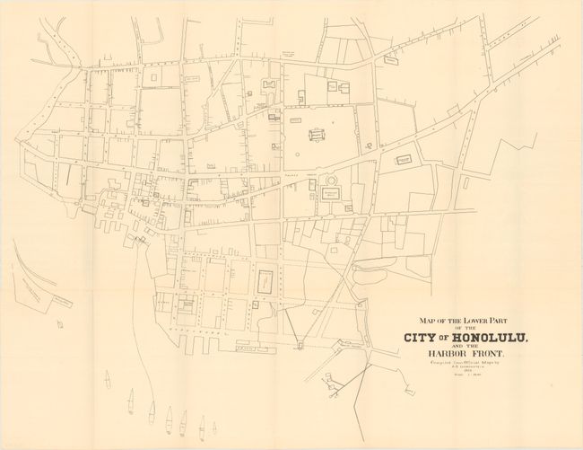
Title:
“Map of the Lower Part of the City of Honolulu, and the Harbor Front”
Map Maker:
Albert Braun Loebenstein
This rare and intricately detailed plan of downtow... (full text available to subscribers)
| Item Detail |
| |
| |
MapMaker: |
Albert Braun Loebenstein
|
|
| |
| |
Subject: |
Honolulu, Hawaii |
|
| |
Period/Size: |
1893 / 22.5" x 28.7" (57.2 x 72.9 cm)
|
|
| |
Color: |
Black & White
|
|
| |
Condition: |
(A) Issued folding with a few tiny splits at fold intersections. (condition help) |
|
| |
Source: |
U.S. 53rd Cong. 2nd Session. House of Representatives. Exec. Doc. No. 47 |
|
| |
References: |
|
|
| |
|
|
| Sales Information |
| |
| |
Price: |
|
|
| |
| |
Offered by: |
Old World Auctions |
|
| |
Catalog: |
Auction No. 171 - Antique Maps, Charts, Atlases & Globes (9469) |
|
| |
Lot/Item #: |
254 |
|
| |
| |
Date: |
02/2019
|
|
| |
| |
|
Antique Maps - Valuation and Pricing, Descriptions, Resources |
|
Home |
Information |
Search |
Register |
Contact Us |
Site Map
Americana Exchange, Inc. © 1999 - 2024 Americana Exchange, Inc.. All rights reserved.
OldMaps.com, the OldMaps.com logo and
AMPR are service marks or registered service marks of Americana Exchange, Inc..
|