| Item Detail |
| |
| |
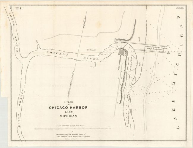
MapMaker: |
Thomas Jefferson (Capt.) Cram
|
|
| |
| |
Subject: |
Chicago, Illinois, Lake Michigan |
|
| |
Period/Size: |
1839 / 11.2" x 14.9" (28.5 x 37.9 cm)
|
|
| |
Color: |
Black & White
|
|
| |
Condition: |
(A) Issued folding on a clean sheet with one faint spot and just a hint of offsetting. (condition help) |
|
| |
Source: |
Sen. Doc. 140, 26th Congress, 1st Session |
|
| |
References: |
Claussen & Friis #330. |
|
| |
|
|
| Sales Information |
| |
| |
Price: |
|
|
| |
| |
Offered by: |
Old World Auctions |
|
| |
Catalog: |
Auction No. 171 - Antique Maps, Charts, Atlases & Globes (9469) |
|
| |
Lot/Item #: |
258 |
|
| |
| |
Date: |
02/2019
|
|
| |
| |
|