| Item Detail |
| |
| |
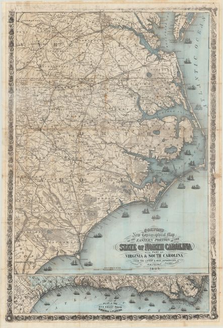
MapMaker: |
Joseph Hutchins Colton
|
|
| |
| |
Subject: |
North Carolina, Civil War |
|
| |
Period/Size: |
1864 / 39.9" x 27.0" (101.4 x 68.6 cm)
|
|
| |
Color: |
Colored
|
|
| |
Condition: |
(B) Original wash color with an overall dark impression with the exception of the top border, which appears not to have been inked properly. Issued folding with light toning along several folds, some small stains, and short fold separations closed on ver (condition help) |
|
| |
Source: |
|
|
| |
References: |
Rumsey #3044.000; Stephenson (Civil War) #305. |
|
| |
|
|
| Sales Information |
| |
| |
Price: |
|
|
| |
| |
Offered by: |
Old World Auctions |
|
| |
Catalog: |
Auction No. 171 - Antique Maps, Charts, Atlases & Globes (9469) |
|
| |
Lot/Item #: |
276 |
|
| |
| |
Date: |
02/2019
|
|
| |
| |
|