Title:
“Map of Chickasaw Nation Indian Territory Compiled from Official Records of the United States Geological Survey”
Map Maker:
U.S. Department of Interior
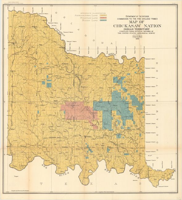
This large, bold map shows the land allotments for... (full text available to subscribers)
| Item Detail |
| |
| |
MapMaker: |
U.S. Department of Interior
|
|
| |
| |
Subject: |
Oklahoma |
|
| |
Period/Size: |
1900 / 33.1" x 30.6" (84.1 x 77.8 cm)
|
|
| |
Color: |
Colored
|
|
| |
Condition: |
(B+) Issued folding with a few short fold separations along the sheet edges, the longest of which enters about 1" into neatline, which have been closed on verso with archival tape. There is faint toning along the fold lines. (condition help) |
|
| |
Source: |
Eighth Annual Report Commission to the Five Civilized Tribes |
|
| |
References: |
|
|
| |
|
|
| Sales Information |
| |
| |
Price: |
|
|
| |
| |
Offered by: |
Old World Auctions |
|
| |
Catalog: |
Auction No. 171 - Antique Maps, Charts, Atlases & Globes (9469) |
|
| |
Lot/Item #: |
278 |
|
| |
| |
Date: |
02/2019
|
|
| |
| |
|
Antique Maps - Valuation and Pricing, Descriptions, Resources |
|
Home |
Information |
Search |
Register |
Contact Us |
Site Map
Americana Exchange, Inc. © 1999 - 2024 Americana Exchange, Inc.. All rights reserved.
OldMaps.com, the OldMaps.com logo and
AMPR are service marks or registered service marks of Americana Exchange, Inc..
|