Title:
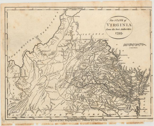
“The State of Virginia from the Best Authorities”
Map Maker:
Esther Prentiss. Lowe
Early map of the state that is finely engraved and... (full text available to subscribers)
| Item Detail |
| |
| |
MapMaker: |
Esther Prentiss. Lowe
|
|
| |
| |
Subject: |
Virginia & West Virginia |
|
| |
Period/Size: |
1799 / 7.4" x 9.8" (18.8 x 24.9 cm)
|
|
| |
Color: |
Black & White
|
|
| |
Condition: |
(B) There is light scattered foxing and the map has been trimmed to just inside the neatline at left. There are binding holes and a few tiny chips in the bottom blank margin. (condition help) |
|
| |
Source: |
New Encyclopaedia |
|
| |
References: |
Wooldridge #177; cf. Wheat & Brun #574. |
|
| |
|
|
| Sales Information |
| |
| |
Price: |
|
|
| |
| |
Offered by: |
Old World Auctions |
|
| |
Catalog: |
Auction No. 171 - Antique Maps, Charts, Atlases & Globes (9469) |
|
| |
Lot/Item #: |
295 |
|
| |
| |
Date: |
02/2019
|
|
| |
| |
|
Antique Maps - Valuation and Pricing, Descriptions, Resources |
|
Home |
Information |
Search |
Register |
Contact Us |
Site Map
Americana Exchange, Inc. © 1999 - 2024 Americana Exchange, Inc.. All rights reserved.
OldMaps.com, the OldMaps.com logo and
AMPR are service marks or registered service marks of Americana Exchange, Inc..
|