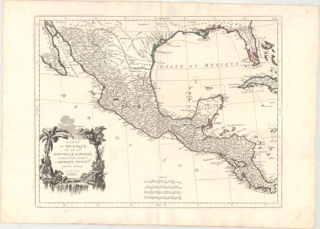
Title:
“Carte du Mexique, et de la Nouvelle Espagne, Contenant la Partie Australe de l'Amerique Septentle.”
Map Maker:
Anville/Santini
A lovely map of Central America, Mexico, the Gulf ... (full text available to subscribers)
| Item Detail |
| |
| |
MapMaker: |
Anville/Santini
|
|
| |
| |
Subject: |
Southern United States, Mexico & Central America |
|
| |
Period/Size: |
1779 / 17.8" x 22.9" (45.3 x 58.2 cm)
|
|
| |
Color: |
Colored
|
|
| |
Condition: |
(A) A dark impression with contemporary outline color on sturdy paper with an "R" watermark and minor marginal soiling. (condition help) |
|
| |
Source: |
Atlas Universel... |
|
| |
References: |
Phillips (A) #647-49. |
|
| |
|
|
| Sales Information |
| |
| |
Price: |
|
|
| |
| |
Offered by: |
Old World Auctions |
|
| |
Catalog: |
Auction No. 171 - Antique Maps, Charts, Atlases & Globes (9469) |
|
| |
Lot/Item #: |
307 |
|
| |
| |
Date: |
02/2019
|
|
| |
| |
|
Antique Maps - Valuation and Pricing, Descriptions, Resources |
|
Home |
Information |
Search |
Register |
Contact Us |
Site Map
Americana Exchange, Inc. © 1999 - 2024 Americana Exchange, Inc.. All rights reserved.
OldMaps.com, the OldMaps.com logo and
AMPR are service marks or registered service marks of Americana Exchange, Inc..
|